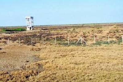
Eco-destruction? Narmada's natural flow down to what it was 10 years go, farm lands go saline, fish catch down
 |
| Aliyabet |
The Gujarat government closing down all the 30 gates on the the Sardar Sarovar Narmada dam in June this year may have "helped" raise the water level to the full reservoir level, 138.68 metres, swelling the dam’s live storage from 1.27 million acre feet (MAF) to 4.73 MAF. However, this has allegedly led to a major ecological destruction downstream of the river, 150 km away, on the river mouth, on the Gulf of Khambhat.
Says South Gujarat's well-known environmentalist MSH Sheikh, who heads the Brackish Water Research Centre, Surat, the flow in the river, despite increase in the dam's capacity, has actually gone down to what it was 10 years ago. He has told Counterview, "It was decided to release 600 cusecs (cubic feet per seconds) of environmental flow by dam authorities without considering the effects on downstream at the time of planning the dam."
Pointing out that even this 600 cusecs of water is only being released "on paper", Sheikh says, "A recent National Green Tribunal (NGT) order said that 25% of river flow should be considered as ecological flow for downstream area", adding, the main reason behind this is the dam authorities' belief that "the release in the downstream is wastage of the fresh water; they have no value for the 150 km of Narmada river downstream from the dam."
He notes, "Narmada is the biggest west flowing river which had the continuous freshwater flow necessary for fish breeding throughout the year. The flow has come down drastically. The fresh water flow is confined to merely 20 meters of the riverbed at Chandod in the downstream of the dam, though the width used to be 250-300 metres before the dam was constructed."
Another major ecological consequence of the "non-release of the fresh water", says Sheikh, has been "tidal water intrusion much deeper than before", insisting, "The salt water is affecting farmers. Farmers on the river bank cannot take the river water for agriculture as it has no dilution of freshwater. Tidal effects are depositing silt in the mouth of the river from Bharuch to Dahej, creating the various mud islands."
Pointing out that "the morphology of the river and riverbed is totally changed due to the decrease of river flow", Sheikh says, "There was a delta of river Narmada when the Sardar Sarovar dam was not constructed, which was called Aliyabet, having lush green 'aal' grass. The villagers of the northern and southern portion of the river were grazing animals on it. After the construction of dam and non-release of adequate water, the delta has disappeared."
"The southern portion of the delta has merged with the land and created a desert", Sheikh says, adding, "Decrease in the river water level has made the entire estuary very shallow. The fishermen are not having adequate depth in the estuarine mouth. Uneven topography has permanently changed the river estuary and delta."
According to Sheikh, "The fishermen who were fishing before the dam was constructed from Hansot to Kantiyajal in 20 km stretch in southern portion of the delta do not have the river any more, as it has merged in land and become desert. The Pagadiya fishermen have to go tens of km away from their native village for fishing."
Meanwhile, in order to come to grips with the ecological destruction because of the reduced release of water from the dam, the state government has proposed Bhadbhut barrage on the mouth of the river. Sheikh says, "Fishermen are opposing the barrage as they are now fishing in the flowing river during the tidal water in the river and the estuary."
He adds, "The closer of the estuary at Bhadbhut will shorten their fishing ground and breeding ground of Hilsa fish, which is one of the major fish species in Narmada river and estuary. All movement of the water flow will stop, which will result in stopping of breeding of the species, which requires brackish water area where the salinity varies."

Comments